Photo: Bureau of Meteorology
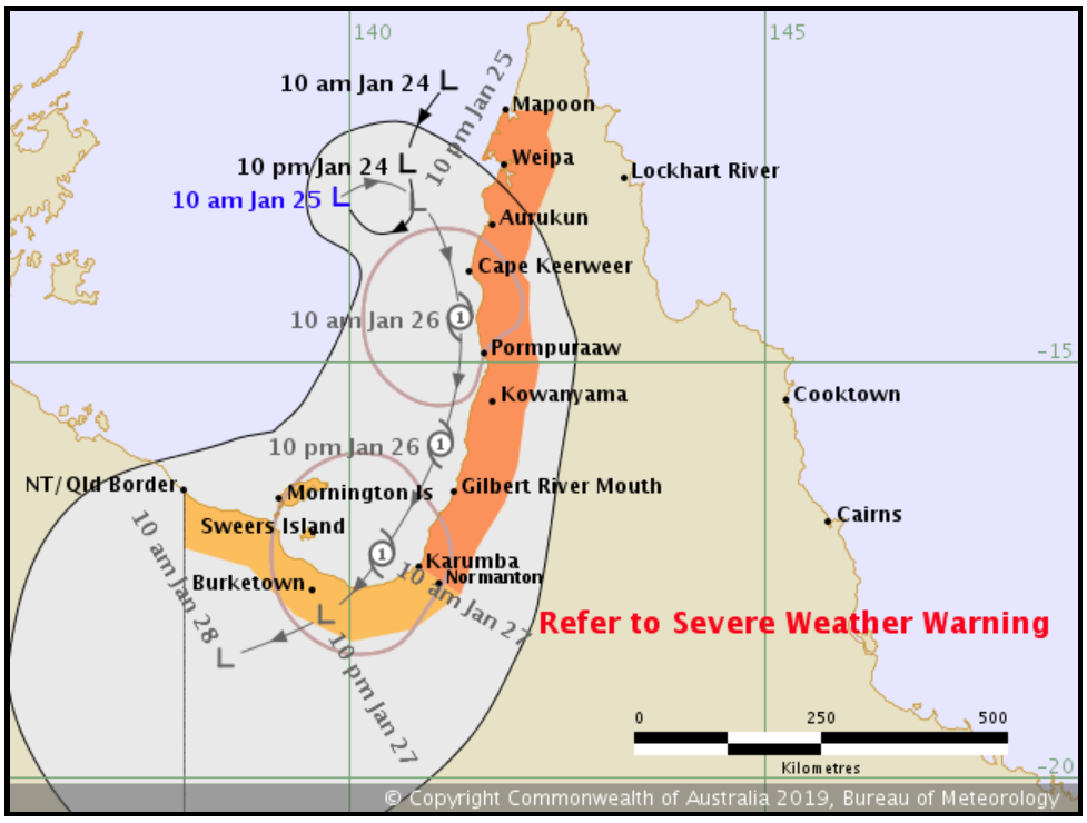
Far north Queensland is bracing for another cyclone as a tropical low bringing damaging winds, heavy rainfall, flash flooding and abnormally high tide builds strength in the Gulf of Carpentaria.
The system is expected to approach the western coast of the Cape York Peninsula on Friday and there remains a high chance that the low will form into a tropical cyclone, to be named Savannah, on Saturday.
A cyclone watch is current from the Northern Territory/Queensland border to Karumba including Mornington Island and Sweers Island.
Damaging winds with gusts over 90km/h may develop about coastal areas between Mappon and Karumba from early Saturday.
While heavy rainfall is already affecting the northern Cape York Peninsula and is expected to spread southwards to the remainder of the Peninsula as well as the eastern Gulf Country and the North Tropical Coast and Tablelands on Saturday.
A Severe Weather Warning and Flood Watch are current for these areas with six-hourly rainfall totals of 100-150mm likely.
The Bureau of Meteorology has warned of even heavier falls if thunderstorms develop.
Communities north of Coen have seen the highest falls so far, with heavy rain expected to begin affecting areas south of Port Douglas, including Cairns, on Saturday.
Higher than normal tides are also expected along the eastern Gulf of Carpentaria coastline over the next few days and in parts, while water levels on the high tide could exceed the highest tide of the year.
Residents are recommended to take precautions and consider what action they will need to take if the cyclone threat increases.
Information is available from local governments, for cyclone preparedness and safety advice, visit Queensland’s Disaster Management Services website (www.disaster.qld.gov.au) and for emergency assistance call the Queensland State Emergency Service on 132 500.